 Frajka-Williams
Project - MerMEED
Mechanisms responsible for Mesoscale Eddy Energy Dissipation
Synopsis
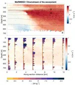
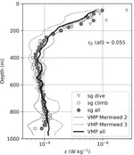
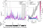
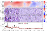
MerMEED investigates the processes responsible for the widespread dissipation of oceanic mesoscale eddies at western boundaries. The project combines focused measurements of small-scale turbulence in four short research cruises, multi-year mooring and satellite observations, and multi-month glider surveys of mesoscale eddies impinging on the continental slope east of the Bahamas.
Aims
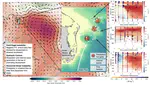
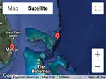
Our aim is to observe mesoscale eddies when they encounter topography at the western boundary of the Atlantic. These eddies arrive sporadically (spaced out by a few months) so we are using sea surface height observations from satellites to get a look at what eddies are there and make short timescale predictions about when they’ll arrive at the Bahamas.
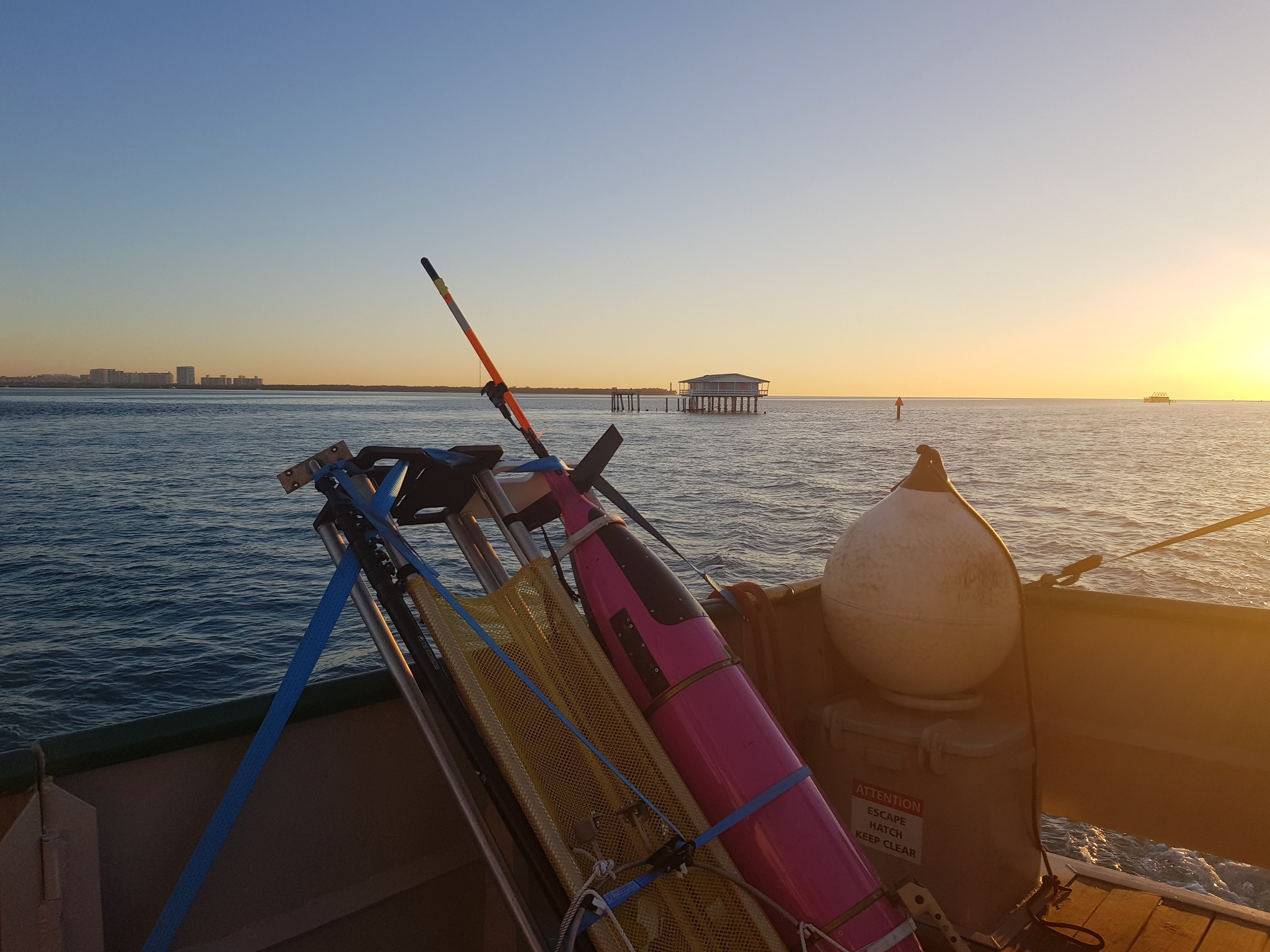
Fundamental physics dictate that most eddies move slowly westward, and these eddies are visible in satellite measurements of sea surface height a few months before they arrive at the boundary. In the project MerMEED, we will watch the eddies in near real-time satellite data, and when an appropriate eddy approaches the east coast of North America, we will deploy a small team of researchers, with advanced instruments, to meet the eddy upon arrival. There, we will survey the eddy using high-resolution profilers deployed from small boats and autonomous underwater vehicles called Seagliders.
After the ship-based survey is completed, the gliders will continue to observe the eddies for several months, as the eddies are slowly disappearing. These gliders transmit their measurements via satellite communications back to our base station in England. We also plan to use the existing observations from the joint UK/US-funded RAPID programme, measuring ocean circulation at 26°N. We will install additional high-resolution velocity and temperature meters on one of these moorings, to make continuous observations of the eddies over 18 months. From the survey, glider and moored measurements, we will be able to assess how important local dissipation is to the disappearance of eddies. We will use our findings to shed light on the processes responsible for eddy disappearance from the oceans, and how those processes change in time.
Funding
PI: Eleanor Frajka-Williams (University of Southampton), Grant reference: NE/N001745/1
PI: Eleanor Frajka-Williams (NERC National Oceanography Centre), Grant reference: NE/N001745/2
PI: Eleanor Frajka-Williams (National Oceanography Centre), Grant reference: NE/N001745/3
Eleanor Frajka-Williams
Professor of Ocean Dynamics in a Changing Climate
I am a physical oceanographer who uses ocean observations to investigate ocean dynamics and circulation in a changing climate. I have a particular interest in problems spanning scales (from micro- to large-scale) or spheres (biogeosphere, cryosphere, atmosphere), and in methods that leverage traditional observations with new platforms and satellite data.